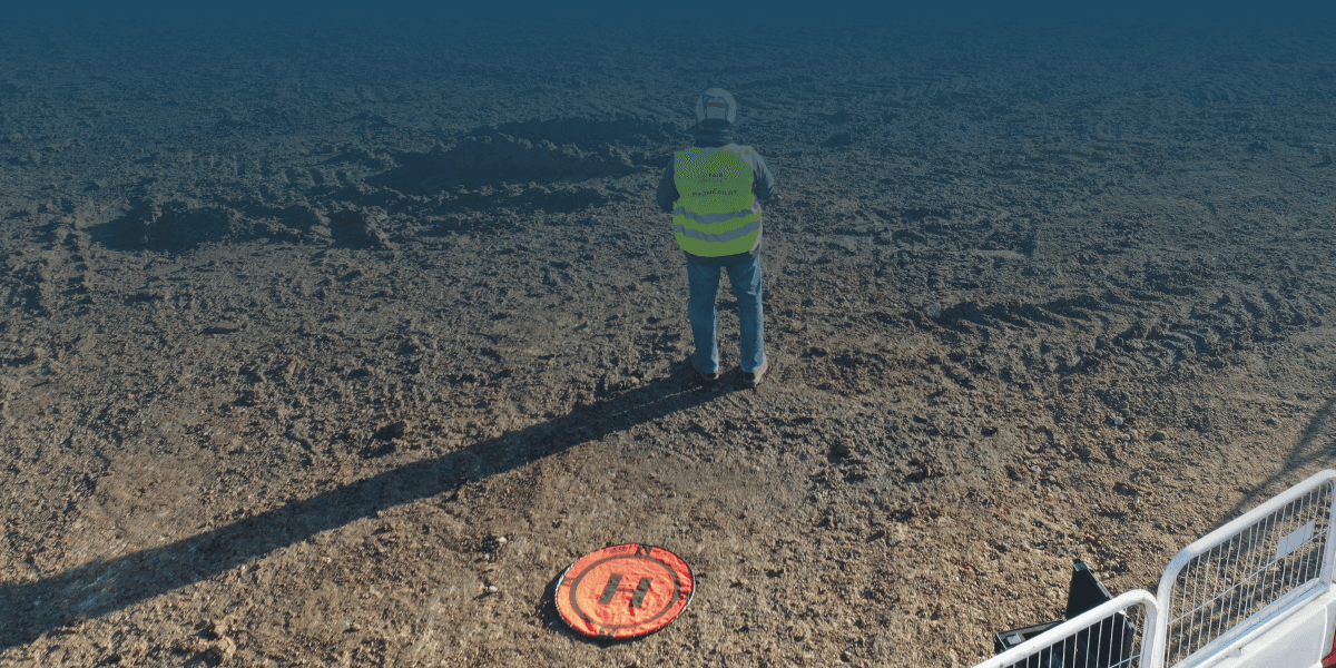
You can't fix what you can't see
Drone-based thermal imaging enables precise PV inspections by detecting defects and performance issues invisible to the naked eye. FairFleet delivers high-resolution results across entire sites through standardized workflows, fast turnaround times, and a global pilot network.
Fully aligned with IEC and DIN standards, our platform gives seamless access to all results — helping you improve performance, reliability, and asset lifespan.
Choose FairFleet for fast, safe, and cost-effective PV thermography at scale.
DETECT AND RESOLVE PERFORMANCE ISSUES QUICKLY
Boost solar energy output by quickly identifying and resolving onsite issues.
Our drone-powered thermography inspections provide fast, accurate results, with AI-driven anomaly detection to prioritize critical issues.
Trust compliant reports aligned with IEC TS 62446-3 standards to ensure reliable performance and stakeholder confidence.
GET STARTED
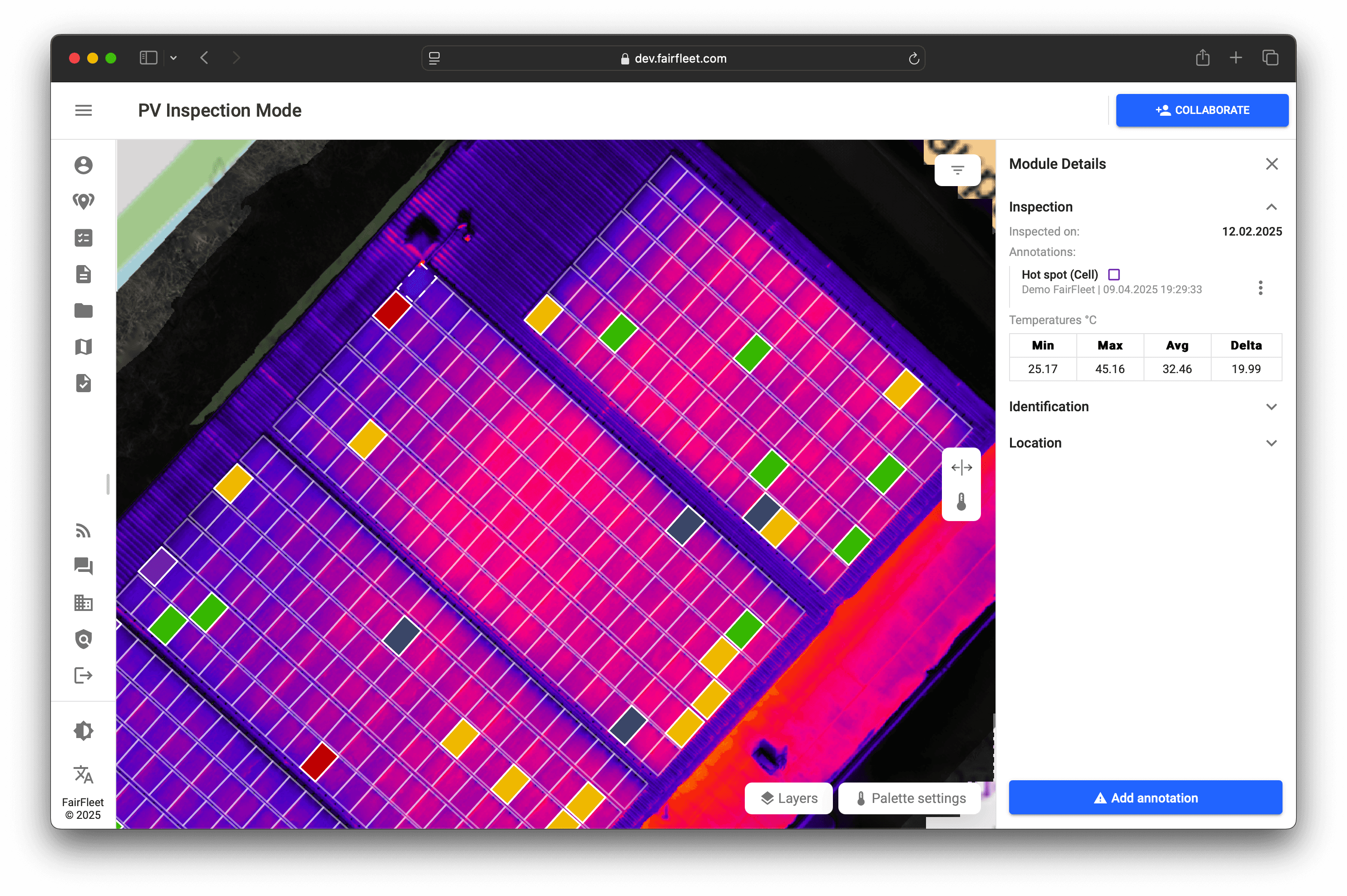

A Digital Twin for Every Detail
The FairFleet Platform creates a complete digital twin of your site, storing all relevant data down to the module level. This centralized solution ensures that every detail is documented and accessible - so issues can be identified and resolved quickly, with all information in one place.
GET STARTED
Side-by-Side Views for Solar Site Analysis
The FairFleet Platform supports multiple base map layers - including high-resolution RGB imagery, thermal orthomosaics, and detailed site plan overlays. A side-by-side comparison feature enables precise cross-view analysis, ensuring accurate detection and validation of anomalies. All industry-standard thermal palettes are supported for in-depth thermal diagnostics.
GET STARTED


MANAGE TASKS ON SITE
Create, assign, and track tasks for anyone and any issue directly within the platform. Clear ownership, transparent status updates, and seamless collaboration ensure work stays structured and projects move forward efficiently.
GET STARTED

INSPECT PLATFORM POWERED BY AI
Drone inspections meet AI precision with FairFleet Inspect, swiftly identifying property anomalies for urgent action. Our system simplifies property surveys, enabling quick, informed decisions.

References
"Drones have been a game changer for our design team to quickly and accurately plan photovoltaic installations."

GROUP LEADER ENGINEERING
BayWa renewable energy GmbH
Trusted by INDUSTRY LEADERS
With over 1.000 clients across various industries - authorities, governments, insurance, finance, construction, real estate, infrastructure, and utilities - we’ve completed projects in more than 70 countries, delivering results worldwide.